World's First Approval from Classification Society for a Drone-based FPSO Hull Thickness Measurement - Joint Demonstration with Terra Drone in Brazil -
Tokyo, Dec. 19, 2023
MODEC, Inc. ("MODEC") and Terra Drone Corporation (“Terra Drone”) are pleased to announce the completion of the drone-based hull thickness measurement of a crude oil storage tank of FPSO (Floating Production, Storage and Offloading system) Cidade de Mangaratiba MV24 operated by MODEC in Brazil, by November 12, 2023. This measurement method has successfully obtained the world’s first approval from the American Bureau of Shipping (ABS) for the FPSO sector.
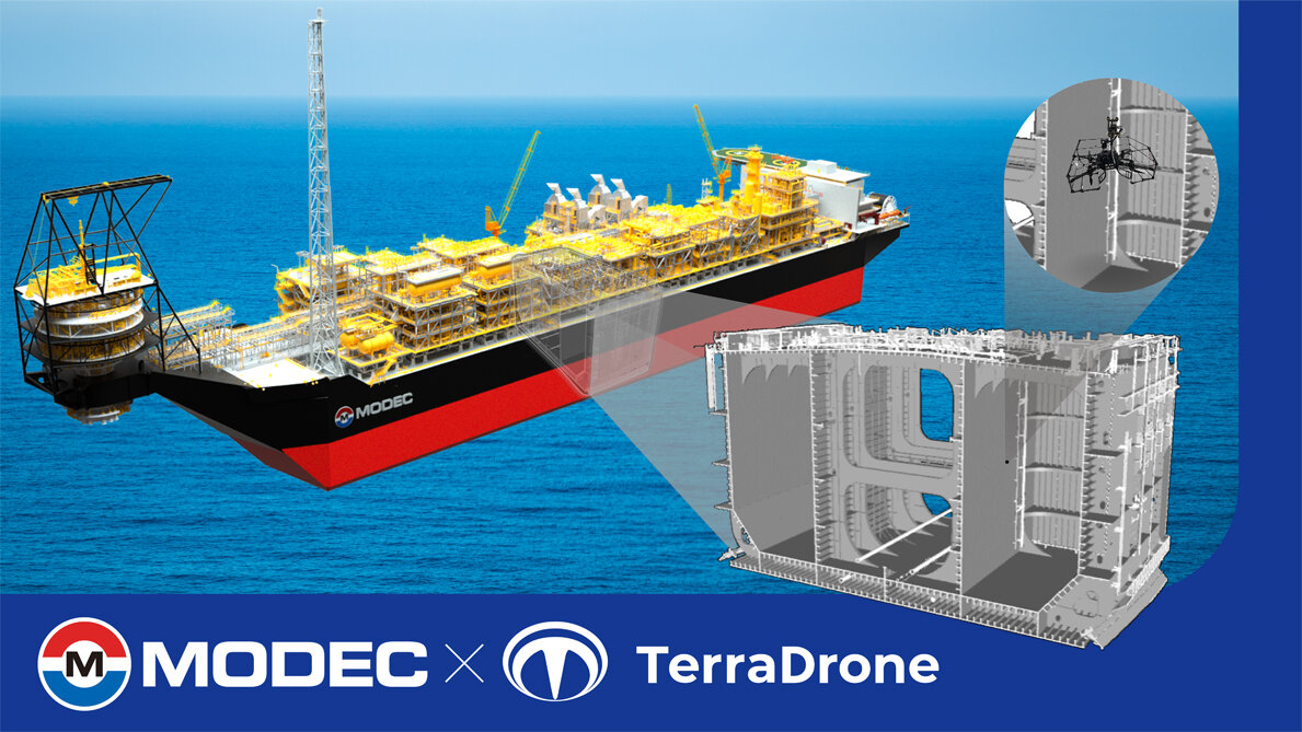
Traditional crude oil storage tanks inspection poses significant occupational safety and health concerns, as they involve confined space entry and working at 30 meters heights. Moreover, these inspections typically require inspectors to manually record approximate measurement points on paper. Therefore, it is difficult to measure the exact same points among each regular inspection, making it challenging to maintain traceability of the measurement points.
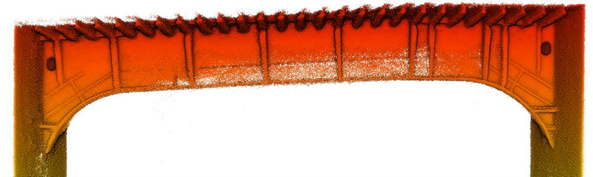
Utilizing Terra Drone's Terra UT Drone, equipped with ultrasonic testing capabilities for non-destructive testing, inspectors can now safely operate the drone from a safe area inside the tank. This eliminates the work at height and ensures a safer inspection process. Furthermore, the drone enhances the inspection process by capturing video images and acquiring 3D point cloud data*1, significantly improving the traceability of measurement points.
MODEC will continuously commit to enhancing the asset integrity*2 of offshore platforms through digital transformation (DX) by developing a high-precision digital twin model*3 using the highly traceable measurement data obtained through drones.
MODEC and Terra Drone have already completed a second inspection on November 25 at FPSO Cidade de Angra dos Reis MV22, located approximately 300 km off the coast of Rio de Janeiro. MODEC and Terra Drone will continue to apply this method to regular inspections on FPSOs to build a track record and further develop the technology. The two companies will contribute to the sustainable operation of FPSOs and other offshore platforms from environmental, economic, and social perspectives by enhancing safety, reducing labor, and increasing efficiency in inspection operations.
- Notes for editors:
- *1 3D point cloud data : a set of points data with 3D coordinates obtained from 3D scans using drones, photogrammetry, ground-based laser scanners, etc.
- *2 Asset integrity : the ability of an asset to perform its intended function safely, effectively and in compliance with all relevant regulations, while minimizing risks to people, the environment, and the asset itself. It enables improvements in competitiveness and fosters sustainable growth.
- *3 Digital twin model : a virtual model that replicates physical objects and systems from the real world in the digital realm. This enables optimization of design and operation, predictive maintenance, simulation, and cost reduction, among other benefits.